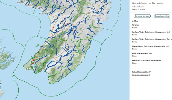
Natural Resources Plan water quantity allocations
This map is designed to show people information about consented water allocations and usage in a particular catchment area.
For each catchment, it shows:
- How much water is available for allocation
- How much water has been allocated through resource consents
- How much water has been used
The data and information come from Greater Wellington’s Natural Resources Plan, Environment and GIS systems. Sharing if this way helps us to be transparent to our community and have confidence in managing our water quantity resource.
Please read the conditions of use associated with this web application. Users are strongly encouraged to confirm water availability for any particular location with Greater Wellington’s consenting staff prior to making an application for resource consent or undertaking other activities related to acquiring water for the first time (e.g. drilling a new bore).
Enquiries can be made to notifications@gw.govt.nz.
Get in touch
- Phone:
- 0800 496 734
- Email:
- info@gw.govt.nz